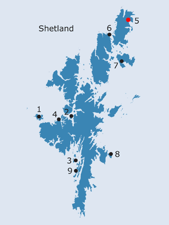
SHETLAND: S5. Papil, Unst · Introduction Papel first appears on Blaeu’s map of 1654; although Blaeu’s geography of Unst is rather confused, Papel, like Croce kirk (see below), has a church symbol. Papil lies slightly above the 50’ contour line, half a mile north-east of the village of Haroldswick; the name is shown on the modern map, but does not appear on either the OS First or Second edition, although there are buildings in its vicinity on both the earlier maps. In folk etymology, Haroldswick takes its name from the traditional resting place of Harold Finehair, supposedly killed during a punitive raid on Unst; Harold, in fact, died peacefully years following the raid in Norway, but - given that it is unusual in Shetland for a bay to be named after an individual - it implies that whoever Harald was, he was of some significance locally (Stumman Hansen and Waugh 1999, 125, 141; NMRS no. HP61SW19, HP 6308 1108). Papil is depicted on the OS First edition map as two roofed buildings, an enclosure and another small building, connected to the road to the west by a track (1880). It is described as a croft house in the Name Book (1878, Shetland, Book 23, 27) and forms one of a cluster of similarly sized farms lying on the relatively fertile ground on the north side of Haroldswick (land capability 42-see below). Little change is visible on the OS Second edition map (1900). Desk assessment and walkover survey as part of the Shetland Chapels Project suggested that there were no archaeological features in the vicinity (Brady and Morris 1998, Site 23). The name is first documented in 1360 (DN, III, 310; Ballantyne and Smith, 1999, no.11), in a transfer of lands in Unst to Herdis Thorvaldsdatter,46 and again in a conveyance in 1551(Papelle) (ibid. no.96). Papil or Papilstown, also known as Clibberswick, is mentioned as one of the ‘scattalds’ of Unst in 1771 (Johnston 1911, 193; 1912, 125-6: scattald = ‘group of townships, neighbourhood’, see definition in Ballantyne and Smith, 1999, 301). These facts suggest that this could have been a more important land-holding in the past than it now appears.
The place today is located half a mile from Bothen, one of the two church sites at Haroldswick and the main burial place for the district (Muir 1885, 73, 143; see below). Interestingly, Bothon’s Booth is mentioned in 1771 as a boundary point between the scattalds of Papil and Harl[s]wick (Johnston 1912, 125-6). The church lies on level ground at the head of a gentle slope; it, like the farm of Papil, is surrounded by a complex of small, regularly shaped fields and enclosures, which are predominantly utilised as pasture (Brady and Johnson 2000, 7, 16). The area has a reputation locally for becoming waterlogged (ibid.). Only this church was recorded by the RCAHMS; it consists of the grass -covered remains of a rectangular structure, oriented east-west, built from massive boulders and lying towards the west side of a square enclosure of apparently much later date (Saxby 1905, no. III; RCAHMS 1946, no. 1538; Cant 1976, 15, n.3; Lowe 1988, vol. 2, 176-8; Brady and Morris 1998, Site 4.5; Brady and Johnson 1998; Brady and Johnson 2000). It is surrounded by a considerable amount of demolition debris (Brady and Johnson 1998, 15), within which, close to the east gable, is a very worn tombstone bearing what appears to be the arms of Mowat and Bruce (RCAHMS 1946, no. 1538). There appear to be other early gravestones, to one of which - the tombstone of a laird - was attached a curse, laid upon the occupant by a widow evicted from his land (Saxby 1905, 27). The entrance to the enclosure lies at its north-east corner, while the very ephemeral traces of a feature to the west of the southern end of the enclosure wall may be an earlier boundary (Brady and Morris 2000, 27, where however it was noted that two field surveys have produced ‘no convincing evidence of an early chapel at this site’). The church is unicameral and appears to be quite late in date; Lowe noted the existence of wall plaster, but this is no longer visible (Lowe 1988, vol. 2, 176-8; Brady and Morris 1998, 27). Geophysics, undertaken as part of this phase of the Shetland Chapels project, suggested that there were considerable traces of activity around the enclosure in which the chapel sits. The majority are likely to be agricultural in origin, as they lie outside the rectangular enclosure containing the church; some, however, appear to underlie the present building (Brady and Johnson, 2000, 17-8). Crosskirk is also relevant to this assessment, as Clibberswick seems to be an alternative name for the scattald of Papil (see above). Crosskirk lies about a mile south of Papil, on the north side of Harald’s Wick, and the surviving ruins show it to have consisted of a nave and chancel, within a rectangular enclosure, perhaps a squaring-off of a previous oval one. There is a tradition of an early chapel site on the nearby Cross Ness (Morris and Brady, 1998, 24). There are no recorded fearly Christian monuments from Crosskirk, or Bothen.
It has been postulated that there was one priest’s district in the island of Unst in the medieval period, although the three churches - Baliasta, Lund and Norwick - which later became the head churches of the post-Reformation parishes were all in existence (Cant 1976, 15, n.2; contra FES, Vol. VII, 297). The bishop of Orkney possessed half the corn teinds of each parsonage, the residual teinds being reserved to the vicar (Goudie 1910, 306; Cowan 1967, 12, 141, 158). Sir Andrew Hill was vicar in 1528 and, in 1545, is described as Official of Shetland (Cant 1976, 14, n.69 & 74). Just after the Reformation, William Lauder was being paid a stipend as minister of both Fetlar and Unst, while William Tailyeour acted as reader for Unst (Donaldson 1949, 204). The number of chapels, still surviving in the late eighteenth century must reflect the medieval provision for places of worship.
According to a slightly earlier account of the parish by the then minister, William Archibald, there were at least 22 chapels, each equivalent to a scattald (quoted in Low 1774, 162). The parish of Norwick constituted the north part of the island, Baliasta, the central part, and Lund the southern parish (FES, Vol. VII, 297-8). The principal church of Norwick, at least in later times, was that of St. John the Baptist at Norwick itself (Muir 1885, 144; Dryden 1896, 148-9; Saxby 1905, no. II; RCAHMS 1946, no. 1536; Cant 1976, 15, n.3; Lowe 1988, vol. 2, 159-76; Brady and Morris 1998, Site 4.1; Brady and Johnson 1998; Brady and Johnson 2000). In addition to this church, ‘Within the bounds were a good many chapels - St. Bartholomew’s, near Norwick, the chapel of Holy Rood at Haroldswick, that of St. John the Evangelist, also at Haroldswick, and Clibberswick Chapel’ (FES, Vol. VII, 297). If it is assumed that the chapels of Clibberswick and the Holy Rood at Haroldswick are in fact the same and that the second chapel at Haroldswick is not dedicated to St. John, but is Pitcairne’s Lady Kirk and therefore the church at Bothen, this description compares well with those of other commentators (Pitcairne 1605-17, 157; Muir 1885, 143-4; Saxby 1905, nos. I and IV; RCAHMS 1946, nos. 1537 and 1577; Cant 1976, 15, n.3; Lowe 1988, vol. 2, 159-76; Brady and Morris 1998, Sites 4.2 and 4.3; Brady and Johnson 1998; Brady and Johnson 2000). Although the head chapel is generally thought to be St. John’s, Norwick, St. Mary’s at Bothen is larger and was apparently the main church in Pitcairne’s day (1605-1617, 157). Sibbald simply mentions a church at Harolds-week as one of the three head churches on Unst, suggesting that a hundred years later the situation had not changed (1711, 74). While making no further mention of a second chapel, Sibbald describes the Cross-kirk as old, lending some weight to Muir’s assertion that it was the latter which was the most revered of the two chapels at Haroldswick, as a consequence of which it - rather than St. Mary’s - held precedence (1885, 73; see also Saxby 1905, IV; RCAHMS 1946, no. 1537). Occasional pilgrimages were still made to the Cross-kirk by some of the older inhabitants in 1841 (Ingram and Ingram 1841, 40). Of the six burying places mentioned in the Statistical Accounts (named only in the later account), Norwick and Haroldswick fall into this parish (Mouat and Barclay 1791, 199; Ingram and Ingram 1841, 40). Saxby also records a tradition of a chapel at Burrafirth (1905, no. XVII). By the time the NSA was compiled, a new church at Baliasta, built in 1825 near the old chapel, which had been dedicated to St. John the Evangelist, had become the sole parish church for the island; the glebe, however, seems to have been located at Norwick, as it was at the end of the eighteenth century (Low 1774, 154; Ingram and Ingram 1841, 49; FES, Vol. VII, 297-8).
Documentary evidence tells us that one of the wealthiest Norwegian landowners axcquired a portion (2 marks) of Papil in the fourteenth century. The medieval ecclesiastical situation is confused, with uncertainty as to whether the name might be associated with one or other of the nearby church sites. The lack of early sculpture means that there is no proof of early Christian associations. It is impossible to know whether the name of Papil, when given by the Norse settlers, originally covered a wider area, and it should be looked at in the context of the other local toponymy. Jakobsen (1937, 173) notes the name Sker poba applied to some skerries off Haroldswick (but see comments on poba names above under Site S4). The legends associated with the name Haroldswick cannot be relied upon as evidence of the importance of Norse settlement in this part of the north isles (topographical names such as Norwick and Haroldswick could be early settlement units).47 The Land capability rating has to be seen in the context of the rest of Unst, where there is no better class of land and the only other 42 value is around Baltasound. This is land capable of producing ‘a narrow range of crops’, which in Shetland terms means the best land. These two localities are the only settlements in Unst with any arable potential. It could have been the case that this Papil site may have been an early ecclesiastical settlement associated with the main Iron Age population centre of the island at Baltasound.
· Soil Survey of Scotland Land Capability: Class Description 42
OS maps:
|
||||||||||||||||||