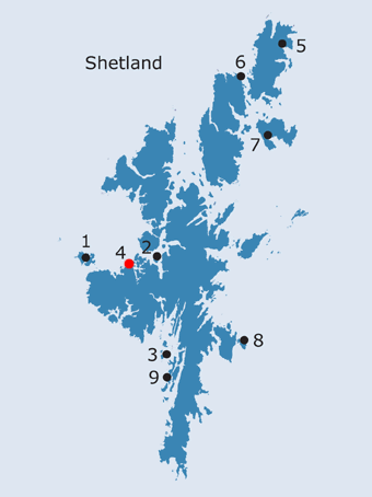
SHETLAND: S4. Pape/Papa Geo, Aithsting centred HU 276 593 · Introduction Pape Geo is a small coastal inlet (NB, Shetland, Book 2, 24), opening out into St. Magnus Bay located on the north side of a headland known as the Face of Neeans. This lies to the south west of the island of Vementry and defines the west side of a number of narrow voes extending southwards into the heart of the parish of Aithsting. The headland of Neing was clearly important enough to be named on several of the earlier maps (Preston 1781; Thomson 1827; Thomas 1838). The name, Pape Geo, first appears on the OS First edition map (1878). Both this map and the Second edition (1900) indicate that this is a very remote area, largely utilised for pasture. A rectangular sheepfold and an enclosure on the eastern tip of the headland are depicted on both maps; the slight remains of stone and turf structures have been recorded around these (SMR no. PRN 4888; HU 2760 5930). No other traces of habitation are shown in the vicinity, although Jakobsen (1936, 171) records Prestalî, presta [h]lí∂, ‘priest’s slope’, near Papegjo. He believed this name to be as likely to be derived from the activities of later priests as the papa of the Early Christian period. Prestalî is not shown on any of the OS maps and Jakobsen’s source for this name is not stated. There is no obvious explanation for how Pape Geo, in conjunction with Prestalî, could fit into the apparent network of ecclesiastical sites and associated settlement in Aithsting described above (under Papa Little). On the mainland, there is a chapel at Setter, in the parish of Walls and Sandness, some distance to the south of Pape Geo; it survives as a green patch in an area of rough pasture (NMRS no. HU25SW24, HU 2075 5058). The burial ground is thought to be contemporary with the chapel and to have remained in use until about 1740 (NB, Shetland, Book 21, 134-5). The possible chapel and burial ground at Vementry, lying just behind the pier which gave access to the island of the same name, may be more significant in an era of sea borne transport; however, the only notice of this chapel appears to be in the Name Book, when the area was in use as a vegetable garden and there is no local knowledge of the site today (NMRS no. HU35NW14, HU 3073 5957). The Land capability value of this area means that it is only of use for rough grazing. It is possible that Neing (Da Neeans)could have been utilised as an area of pasture, or source of peats, by folk from Papa Stour which might account for the name of Papa Geo. George Peterson notes that the people of Papa Stour obtained fuel from Aithsness, as well as West Burrafirth and Papa Little (Peterson 1993, 66). Equally, it might simply be a landing place, along a route extending the length of St. Magnus Bay, between Papa Little, via the more sheltered sound between the island of Vementry and the mainland, to Papa Stour. The only hint of some more direct ecclesiastical connection is the nearby name of Prestali, recorded by Jakobsen (see above). It should be noted that in his discussion of Papa names Jakobsen (1937, 173) draws attention to some coastal terms around Shetland which incorporate a variant form poba or pobi (gen. Sing. or pl. ). These would appear to be a variant of ‘papa’ but perhaps relating to the use of the term in colloquial speech in Shetland meaning either 1)‘foster-father’ and used as a term of caress, or 2) ‘the devil’. The latter he would see as a post-Reformation development from ‘papa’ in the sense of ‘pope’ and resulting from ‘intense hatred of the pope and the papacy’. There is a Gjopoba in Whalsay, apparently an inverted version of Papa Geo. It is therefore quite possible that these were both applied to a geo with some rather different meaning from that of Celtic priests, and cannot be seen as relating to any other ‘papar’ place-name, although Pobis gjo in Muckle Roe does lie directly across the water from Papa Little.
· Soil Survey of Scotland Land Capability: Class 62.
OS maps: |
||||||
