
ORKNEY: O3. Steeven o'Papy, North Ronaldsay, Cross and Burness · Introduction The name, Steeven o’Papy, applied to a coastal feature off the south coast of N.Ronaldsay was first noted by Marwick in the early twentieth century (1923, 55), but does not appear on the OS First edition map or on sea charts of different periods (MacDonald 2002, 27). Marwick, who regarded it as a strange name, applied it to an outlying rock, near the Brae o’ Howmae, and separated from the shore by the Putt Steeven, a deep hole or channel (1923, 57). It seems likely that it derives from styfingr = ‘a stub or stump’(Jakobsen, 1932 sub ‘stivin’). The position of the Steeven o’Papy is still known locally, while the Putt Steeven is used for the setting of lobster creels (Fisher 2002, 49). South Bay, off which it lies, is backed by a broad strip of sand and - as attested by the settlement name, Nouster, on the west side of the bay - was one of the most important landing places on the south side of the island (Marwick 1923, 57, 64). However, it is clear from the OS First edition map that South Bay does become much more rocky below the Brae o’Howmae. The ‘little Fruitful Isle’ (Wallace 1693, 12) does not appear in the earliest Rentals, but in 1595 was skatted at 723/4 pennylands (four ouncelands). This island experienced a surprising change of name from the original Rinansay in Orkneyinga Saga (chaps. 8, 56) to Rognvaldsey or North Ronaldsay to distinguish it from the southern Ronaldsay (OFN, 1). The first form of the island’s name has been taken by many authors to reflect the conversion of the island by St. Ninian or Ringan (Anderson 1873, 1, n.6; Craven 1891, 5-6; Cromarty Smith 1921, 109; Marwick 1923, 54), although - in spite of the attested early spelling of its name - St. Ronald is also given credit for this event (Neale 1848, 116). Taylor would see Rinansey as of unsolved etymology (1931, 44), while MacDonald, on the basis of the survival of the papar coastal name, believes ‘Papy’ to be an even earlier name for the island as a whole (2002, 27). Could it have been the Papay tercia referred to in Fordun’s list of Orkney islands? (Bower, Scotichronicon, I,194-5). It lies in a fairly similar relationship to Sanday as the other Orkney Papays in relation to their bigger neighbour. North Ronaldsay heads Fordun’s list, followed by Papa Westray and Papa Stronsay, while the ‘third Papay’ is at the bottom of the list. Is this an indication that the last name may have been a duplication of the top name? . It was just at this period that ‘Ronaldsay’ appears to have replaced ‘Rinansey’ and become the accepted form, as the two islands of the same name were being distinguished as ‘north’ and ‘south’ in the sources (Marwick 1952, 1). North Ronaldsay was the scene of the dramatic events surounding the murder of Halfdan, son of King Harald Fine Hair, in the 10th century. He is supposed to have been ‘spread-eagled’ as mentioned in the verses composed by Earl Einar (OS, chap.8. although note that the name of the island, where Halfdan was murdered - Rinansey - is omitted in the Palsson and Edward translation).
The traditional tripartite division of North Ronaldsay is clearly visible on Aberdeen’s map of 1769. However, as recorded in documentary sources, these do not correspond entirely to the surviving gairsty dykes, nor to the township divisions, even though believed to do so by the author of the second Statistical Account (Grant nd., 104; Marwick 1923, 55; RCAHMS 1980, 21-2, nos. 127-8; SMR no. OR 202-3). Just as the parish church served the southern third of the island, there appears to have been a religious site within each of the remaining divisions (Clouston 1918, 104, 239). Close to the south eastern tip of the island, to the east of the concentration of sites around South Bay and the Broch of Burrian, was St. Bride’s, which has given its name to many of the natural features around the promontory on which it lies (ibid.). By the early twentieth century, only an area of disturbed ground and a few ‘rough gravestones’ were visible at the site; Lamb noted a low shapeless mound, through which a T-shaped alignment of slabs and one large stone protruded in 1980 (Marwick 1923, 54; RCAHMS 1946, 52, no. 204; RCAHMS 1980, 27, no. 194; NMRS no. HY75SE10, SMR no. OR 192). In the north eastern part of the island, at Sennes, a rectangular platform within the burial ground represents the remains of another chapel; from outside the graveyard, a ‘grave containing stone cist and skeleton’ were recovered in 1872. There is also a local tradition of a ‘Lady well’ in the vicinity, although the name, Corsegate, for the road leading to the graveyard suggests a dedication to the Holy Cross (NB, Orkney, Book 13, 19; Marwick 1923, 54; RCAHMS 1946, 52, no. 203; RCAHMS 1980, 28, no. 196; NMRS no. HY75NE4, SMR no. OR 196). Finally, the name Kirk Taing, for the most easterly point of the island also suggests the presence of an ecclesiastical site. In local tradition, the name derives from a church built near the spot where a cross from a ship in distress had floated ashore (NB, Orkney, Book 13, 77; Marwick 1923, 54, 56; RCAHMS 1980, 27, no. 195; NMRS no. HY75NE15, SMR no. OR 236).
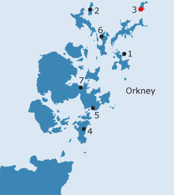
The Brae o’ Howmae, along with the Broch of Burrian and the Brae of Stennabreck, formed a target of William Traill of Woodwick’s late nineteenth century excavations on the island of which he was proprietor. These revealed that the large sand dune at Howmae contained two well-preserved Iron Age wheelhouses, associated with a number of other structures and a paved courtyard (Traill 1885; Traill 1890; RCAHMS 1946, 48-50, no. 195; RCAHMS 1980, 20, no. 107; NMRS no. HY75SE5, SMR no. OR 218, HY 7583 5227). The importance of this area for early settlement is confirmed by the presence of the farm of Kirbest on the west-facing slopes above the shore, while to the south east is a cluster of smaller crofts known as Bustatoun (Marwick 1923, 64). The name Kirbest represents ON kirkiu-bólsta∂r (church farm), although the date and significance of these names has been much disputed. It has been identified as the home of Ragna and her son, Thorstein the Strong, who both figure prominently in Orkneyinga Saga (Clouston 1927, 46; Marwick 1952, 1; Tulloch 1974, 24; Pálsson and Edwards 1978, 102, 128-9, 148). Kirbest forms part of the township of Busta, an eight penny land, which appears on the majority of the early maps and in the 1595 rental of the earldom. It is possible that Kirbest once applied to the whole township, but was subsequently restricted to the farm, thus providing an explanation for the seeming duplication of the bólsta∂r element (Marwick 1923, 55, 64; Marwick 1931, 29; Marwick 1952, 1). Broch of Burrian From the south eastern tip of South Bay, below Hindegeo, the coastline continues southwards to terminate at the Point of Burrian. Here, evidence for early medieval ecclesiastical occupation, in the form of a small iron Celtic handbell and a cross-slab of probably eighth or ninth century date, has been recovered from the broch of the same name(see FIG.03.1).(PSAS 1875; Traill 1880; Craven 1891, 6; Allen and Anderson 1903, 24; Cromarty Smith 1921, 113; RCAHMS 1946, 45-7, 51, nos. 193 & 201; Wainwright 1962, 93, 96, 113, 114-5; Radford 1962, 174; RCAHMS 1980, 16, no. 68; Bourke 1984, 464, 467; MacGregor 1975; Fisher 2002, 49, 52; NMRS no. HY75SE3 & 3.1, SMR no. OR 217, HY 7627 5138). An ogham inscription, which appears to refer to the cross, runs down the left side of the slab (Fisher 2002, 49). In addition, a painted pebble and the phalangeal bone of an ox, with a decorated crescent and V-rod and a mirror case symbol incised into its surfaces, attest to Pictish period occupation at the Broch of Burrian (Allen and Anderson 1903, 25-6; Radford 1962, 170). Even more intriguingly, a stone incised with a five-pointed star on one side and a six-pointed star on the other, also came from the broch (ibid.). A bird, resembling a Pictish goose, sits within the one of the points of the five pointed star, while the other points contain circles. There is also decoration within the centre of the star and a rough crescent, containing another circle, outside it; in contrast, the six pointed star is not ornamented, although there is a suggestion of a three-sided shape in the centre (ibid.). Immediately to the north of the Broch of Burrian, on the east side of the point, is Howar, from ON haugr or haugar, ‘mounds’ (Marwick 1923, 64; Marwick 1952, 2). In the documentary sources, Howar is usually linked with the ‘lost’ house of Hargar, as it is in the 1653 valuation of the island (Marwick 1923, 53-5, 64; NMRS no. HY75SE19, HY 7603 5153). Hargar is taken by Marwick to be the plural of ON horg, a word which can mean either a cairn of stones, a stony hillock or a heathen shrine, although it is perhaps unlikely to mean the latter in this context (1923, 54; Marwick 1952, 8). At Howar, a burial of possibly Early Medieval or Norse date was found in the sand dunes during WW11, with associated, although not necessarily contemporary, settlement,; the dating evidence for the burial is provided by a bronze pin with a penannular head (RCAHMS 1980, 20, no. 114; NMRS no. HY75SE2, HY 7607 5140)
The parish of North Ronaldsay or Ringansay appears to have been linked with St. Nicholas’s on Stronsay from an early date (Cowan 1967, 172). As a result, the parsonage teinds were annexed to the treasurership of Orkney in 1544, remaining so at the Reformation (ibid.). The position of the vicarage is rather more obscure and the failure to effect a union between the united vicarage of Stronsay and the treasureship before 1544 appears to have resulted in a temporary union between the vicarage and that of Lady Kirk in Sanday managed by the vicar of the time. James Annand, Commissioner of Orkney, was paid a stipend of £66 13s 4d for the parishes of North Ronaldsay and Sanday between 1567 and 1569 (Donaldson 1949, 204). This position was maintained until the close of the sixteenth century when the parson of Stronsay and the treasurer of Orkney again appears in possession of the vicarage (ibid.). However, at a later date, the three parishes of Cross, Burness (both on Sanday) and Ringansay (North Ronaldsay) seem to have been again united (Clouston 1791, 482; Grant nd, 112; FES, Vol. VII, 258). The union of the two Sanday parishes with North Ronaldsay appears to be confirmed in 1701 by Brand. He notes that there were two churches in the parish - one on Sanday and one on North Ronaldsay (Brand 1701, 57). That on North Ronaldsay appears, according to Blaeu and Sanson’s maps of the middle of the seventeenth century, to have been dedicated to St. Olaf (NMRS no. HY75SE47, HY 7545 5322).
The present church, built in 1812 or 1815, is located just to the west of Holland, the largest farm on the island and seat of the Traill family (Marwick 1923, 55, 64; Marwick 1952, 2; Hay 1957, 267; Tulloch 1974, 148; Burgher 1991, 100). The foundations of a much smaller, thatched building, on an east-west alignment, were uncovered in the centre of the churchyard in 1924, attesting to the probability that the medieval church was also located on this site (Tulloch 1974, 148-9). The highest point on the island lies to the south west of the church; the site of the beacon mentioned in Orkneyinga Saga, as well as the cairn erected by Earl Einar over the body of Halfdan Long-leg, are thought likely to have been in this vicinity, while evidence for Iron Age settlement has also been found nearby (Clouston 1932, 33-5; Marwick 1923, 64; Tulloch 1974, 26; Pálsson and Edwards 1978, 30-1, 129, 132; RCAHMS 1980, 19, no. 105; NMRS no. HY75SE27, SMR no. OR 230, HY 7538 5322). During levelling of the area around Holland House, the upper part of the mound on which it is situated was found to be made up of ashes and burnt stone, while stone whorls, a steatite vessel and many animal bones were also recovered (Traill 1885, 32-3). Although they could not account for its erection, the people of the island still resorted to the tall standing stone which stands to the south west of Holland at the end of the eighteenth century; on New Year’s Day, around fifty people were seen by the minister ‘dancing with moon light, with no other music than their own singing’ (Clouston 1791, 489; Marwick 1923, 53; RCAHMS 1946, 50-1, no. 196; RCAHMS 1980, 13, no. 31; NMRS no. HY75SE6, SMR no. OR 188, HY 7522 5292). Holland was formerly known as Sand and, alongside Busta and Nes (modern Nesstoun, lying behind Brides Ness, see below), formed the southern third of the island in the 1595 rental of the earldom (REO, no. II, 76-7; Marwick 1923, 54-5: Marwick 1952, 3).
There are many problems about drawing firm conclusions from this insubstantial Papay name. As a coastal term it cannot be relied on as valid toponymic evidence for putting north Ronaldsay into the group of Papay islands, as is discussed under Shetland Sites. Yet there is much about the nature of the island and its archaeology which make it eminently suitable for Papay status! Its ‘secluded’ location at the very northern fringe of the Orkney islands off the large island of Sanday; the fertility of its southern third, where the Broch of Burrian lies; the wealth of material evidence for high-status Iron Age settlement ; the ecclesiastical character of some of that evidence including a cross-slab of early Christian date. All this combined with the indisputable significance of the original island name of Rinansey (OFN, 1) would seem to demonstrate that this is an island which has to be categorised as of significance for the ‘papar’ project.
· Soil Survey of Scotland Land Capability Class 42 (southern third of N.Ronaldsay)
OS maps: |
|||||||||||
)