
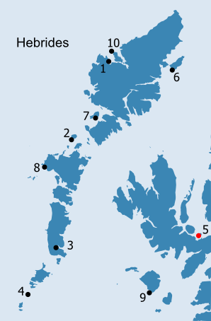
HEBRIDES: H5. Pabay (Strath, Skye) See inventory of place-names in the vicinity of Pabay (Strath, Skye) in Place-Name Appendix H5 · Introduction centred NG 6737 2715 Chapel; burial ground NG 6736 2651 NMRS no. NG62NE 1 SMR no. NG62NE0001 RCAHMS 1928, 207, no. 647 Pabay is a small island which lies in the centre of Broadford Bay, off the south-east coast of Skye (Figs. H5.1 and H5.2). It is located to the west of the narrows of Kyle Akin, which separate Skye from the adjacent areas of the west coast of Scotland (Fig. H5.3). It is thus close to a very important sailing route through the Inner Hebrides. Broadford Bay is ringed by the mountains of Applecross to the north east, those of Kintail to the east and the Red and Black Cuillins to the west. Pabay lies to the south of the much larger islands of Raasay and Scalpay and the usefulness of the sheltered waters at the south end of the Inner Sound as a safe harbour form a feature of many early accounts of the area (Fraser 1793, 224; Macculloch 1824, 404-5). These waters have also helped to create the excellent fishing grounds between Pabay and another small island, Longay, which lies to the north (Ratcliffe Barnett 1927, 156). Its sedimentary geology has given Pabay a quite different character to the other Pabay islands: The flat and fertile island of Pabba is of a roundish figure and about three miles in circumference . it forms a flat table scarcely sixty feet high, the south-eastern side being elevated and abrupt, while the opposed one declines to the water's edge ; the whole being surrounded by low reefs of rocks causing a foul shore (Macculloch 1819, 422). Hugh Miller waxes enthusiastic about the fossil-rich rocks: [Anchored in Broadford Bay] The seaward view is more pleasing. The deep russet of the interior we find bordered for miles along the edge of the bay with a many-shaded fringe of green ; and the smooth grassy island of Pabba lies in the midst, a polished gem, all the more advantageously displayed from the roughness of the surrounding setting. . The entire island, too, so green, rich, and level, is itself a specimen illustrative of the effect of geologic formation on scenery. We find its nearest neighbour,-the steep, brown, barren island of Longa, which is composed of the ancient Red Sandstone of the district,-differing as thoroughly from it in aspect as a bit of granite differs from a bit of clay-slate ; and the whole prospect around, save the green Liassic strip that lies along the bottom of Bay of Broadford, exhibits, true to its various components, Plutonic or sedimentary, a character of picturesque roughness or bold sublimity. The only piece of smooth, level England, contained in the entire landscape, is the fossil-mottled island of Pabba. . This island, so soft in outline and colour, is formidably fenced round by dangerous reefs . He would be a happy geologist who, with a few thousands to spare, could call Pabba his own. It contains less than a square mile of surface ; and a walk of little more than three miles and a half among the line where the waves break at high water brings the traveller back to his starting point ; and yet, though thus limited in area, the petrifactions of its shores might themselves fill a museum (Miller 1858, 163, 169-70). The island is formed from shales and shaly sandstones of the Lower Lias (Jurassic limestone series), through which a number of Tertiary doleritic and basaltic dykes have intruded. It is these which extend out from the shore, making landing on Pabay difficult, a feature most clearly illustrated by the Admiralty Chart of 1857 (Fig. H5.2). The shales and sandstones have been overlain by raised beach deposits producing fertile soils (in modern land capability terms, class 5/1) across all but the south west part of the island, which is dominated by peat (class 6/3), though most of the south east corner of the island is also described as 'moss' on the earlier editions of the OS map (1882, 1904). A shell beach at the northeast corner of the island will have provided useful additional fertiliser. Occupation of the island, in the form of midden material and lithics found in two locations, can be traced back to the prehistoric period, perhaps as far back as the Mesolithic (NMRS no. NG62NE 3, NG 6771 2657 and NG62NE 4, NG 6770 2794). However, there is little evidence for settlement to bridge the gap between the Mesolithic and the sixteenth century. From this period onwards, the island is shown on maps and charts, being first named on Blaeu's map of 1654. There is now a single occupied farm on the west side of the island, which has been in existence since at least the 1860s (Muir 1861, 164; Ratcliffe Barnett 1927, 156; NMRS no. NG62NE 2, centred NG 6707 2646). The jetty, which first appears on the OS Second edition map (1904), lies at the south-western corner of the island; it is also possible to anchor off this point, while the beacon Sgeir Gobhlach appears on the First edition map (1882) (Haswell-Smith 2004, 153). A cluster of roofed and unroofed buildings is shown at the head of the jetty on the OS First edition map (1882), while a sheep pen is depicted on the current edition in this location.
The strategic location of Pabay may have given rise to its sixteenth-century reputation as being a haunt of 'pirates and so-called "broken men"' (Haswell-Smith, 2004, 153): At the shore of Sky foresaid, lyes ane iyle callit Pabay, neyre ane myle in lenthe, full of woodes, guid for fishing, and a main shelter for theives and cut-throats. It perteins to M'Kynnoun (Monro 1549 (1994), 505). By the eighteenth century Pabay had been cleared of trees and was significant for its pasturage (Pennant 1774 (1998), 282). This was particularly important for the black cattle on which much of the wealth of Skye was based: A League further North lies the Isle Pabhay, about two Miles in Circumference, it excels in Pasturage, the Cows in it afford near double the Milk that they yield in Skie. In the Dog Days there is a big Flye in this Isle, which infests the Cows, makes them run up and down, discomposes them exceedingly, and hinders their Feeding, insomuch that they must be brought out of the Isle, to the Isle of Skie ; this Isle affords abundance of Lobsters, Limpets, Wilks, Crabs, and ordinary Sea Plants (Martin 1703 (2003), 162). In the First Statistical Account the importance of the island for winter grazing is stressed; here the island is said to have been able to support 70 to 80 cattle, but only for half a year, a qualification which may also underlie Martin's story of the Dog Days (Fraser 1793, 223). The island was still owned by Mackinnon, being tenanted by a cadet branch of the family at the beginning of the eighteenth century (Nicolson 1930 (1994), 127-8). Pabay lies in the parish of Strath, which with Sleat, forms the most fertile part of Skye. Areas of better ground surround Broadford Bay and Pabay, where the cattle could be taken while the crops ripened, may have been particularly important in this context. PABBA, like most others of the name, is a low grassy island of small size, lying two or three miles out from Broadford. Though now with scarcely a bush, and inhabited by one family only, in Dean Monro's time (1594) it was "full of woodes, guid for fishing, and a main shelter for thieves and cut-throats." It is not certain to what saint the church was dedicated. Of it nothing exists but the foundations its external length was only 21 feet. There is difficulty in determining the precise limits of the burying-ground, but it seems to have included two other buildings, the most preserved of which is a curious semicircular structure rudely and somewhat irregularly formed of uncemented stones of large size, and measuring 9 feet from north to south, and 6 from east to west. In local speech it is the Altar, but whether of Christian or Pagan dedication, no one presumes to know. In the centre of it is an irregular circle of stones, smaller than those without, and on the south the enclosing wall of the outer building is formed lengthways of two large oblong blocks, placed a little asunder at the middle so as to leave an entrance-way between (Muir 1861, 164-5). Neither the Altar (Fig. H5.4) nor any additional buildings are mentioned by the surveyors for the first Ordnance Survey a few years later and they were equally at a loss as to the date, lifespan and dedication of the chapel, although a pencil note that it was quite evidently 'one of the many Culdees Chapels to be found in the Western Hebrides' was subsequently added to their description (Ordnance Survey 1876, Original Object Name Books, Inverness-shire, Book 11, 43). The 'Ruins of' the chapel are shown within an oval enclosure, annotated as 'Graveyard disused', on the First edition map (1882). The RCAHMS do note the presence of two buildings, one to the north west and one to the south west, both of which lie outside the graveyard enclosure and which they considered to be much later in date. The chapel lies on the east side of the only burn, which runs from the centre of the island to the southern shore, and is situated on some of the poorer, more marshy ground on the island (as is the present farm) (Fig. H5.5). In spite of the lack of antiquarian and archaeological knowledge of the chapel, it does figure prominently in local tradition. According to Lamont's history of the parish of Strath, the site was originally 'a Druidical grove' in which 'a little Christian chapel' was built, following the conversion of Skye by St. Maolrubha (1913 (1983), 39). The possibility that Maolrubha was specifically associated with the church on Pabay is perhaps significant given the potential links between Pabay and two of the early church sites closest to the island. On the mainland of Skye, more or less opposite Pabay, is Cill Ashik, which has strong connections with Maolrubha (ibid., 33ff; Forbes 1923, 52-3; Seton Gordon 1950, 62-3) and archaeological evidence confirms that the religious significance of the site does extend back into the Early Medieval period (NMRS/SMR no. NG62SE 1, NG 6867 2426). This consists of a tenth-century strap end found in a rabbit burrow in the north east corner of the graveyard. The associated Tobar Ashaig has a graffiti-style cross (Fisher 2001, 102; Fisher 2002, 41-2; NMRS/SMR no. NG62SE 26, NG 687 242). Ashik (which derives from the Gaelic word for ferry, aiseag), first appears as Askimilruby in 1505 (OPS, 343-4; Forbes 1923, 52; Watson 1926 (1993), 288). Traditionally, Maolrubha is said to have floated across to Ashig from Applecross on a large stone (Lamont 1913 (1983), 33-4). On the largest of the three Crowlin Islands, which lie off the southern tip of the Applecross peninsula, bridging the distance between Applecross and Pabay, there is an annat name. No structural traces remain and it survives simply as the place-name, Port na h-Annaide or Camus na h-Amait. Confusingly, it is Crowlin Beg which is named as St. Rufus's island, 'the red priest's island', on Thomson's maps (Reeves 1862, 281-2; OPS, 402; Watson 1926, 253; OS First Edition Sheet CIXA 1875 (1880); NMRS/SMR no. NG63SE1, NG 6964 3472). Away from the fertile lands around Broadford Bay, on the west side of the parish, there is another early church site, dedicated to St. Maolrubha, at Kilmaree (Lamont 1913 (1983), 40-2). Kilmori, Aisk and Pabba are noted as three of the four 'Popish chapels' in the parish at the end of the eighteenth century (Fraser 1793, 226). However, the chapel on Pabay is associated with St. Columba in a story recounted by Otta Swire about an encounter between a priest from Pabay and the 'little people' (Swire 1952 (1999), 13). St. Columba is strongly associated with Skye, although - according to Adomnan's Life - the purpose of the two visits he made to the island are unclear (Nicolson 1930 (1994), 10; Sharpe 1995, 136-7, 175, 293-4). The 'Cathedral of the Isles' at Skeabost, the possible monastic site in Loch Choluim Chille, near Uig, Eilean Chaluim Chille in Loch Portree (the loch was formerly also called after Columba), and two of the islands off the north coast (Fladda Chuain and Eilean Trodday) are all dedicated to St. Columba (Nicolson 1930 (1994), 10). How much weight can be placed on these dedications and the potential affiliations is unclear; it is possible that Columba's cult dominated in the northern half of the island, while Maolrubha's cult held sway in the south (ibid.). The association of Pabay with Columba may, therefore, represent a mistaken assumption that Columba was the most significant saint in Skye. Immediately to the north of Pabay, the chapel on the island of Scalpay, with its plain outline Latin cross, is dedicated to the obscure St. Frangaig, while the important church on Raasay, the larger island to the north of Scalpay, with its varied collection of sculpture, is dedicated to St. Moluog, bishop of Lismore (Fisher 2001, 102-3, Fisher 2002, 41-2). Of the other ecclesiastical sites in the parish of Strath - in addition to Pabay, Kilmaree and Ashaig - the parish church, which is dedicated to Christ, forms the fourth of the Popish chapels mentioned by Fraser (1793, 226). Fraser's successor as minister of the parish, Mackinnon, adds Kilbride and Teampuil Chòain at Boreraig, both on the west coast, to the list. Another annat place-name, surviving as Clach na h-Annait and Tobar na h-Annait, both of which are close to Kilbride and Tobar Chliamen (?St. Clement's Well), complete the picture (Mackinnon 1840, 302). Both Lamont and Swire believed the chapel on Pabay to have fallen into disuse at an early date. Lamont saw this as a result of Viking raids, but that, while Ashaig and Kilbride were not rebuilt, Teampull Frangaig and the church on Pabay were brought back into use by the converted Norsemen (Lamont 1913 (1983), 50-2). Swire provides no indication of date for the abandonment of the church on Pabay; after the monks had left, robbers and outlaws, who had found a refuge on the island following the clearance of the woodland from the rest of Skye, were eventually overcome by the devil, who had been invited by the chief of the robber band (1952 (1999), 13-4). The chief was not to reap any reward - at least in this world - as his sword, which had a cross hilt, did not protect him from a black cat who caused him to drop his sword blade and disappear. In later tradition at least, Pabay was seen simply as one of a dense network of early Christian sites in this locality.
OS Maps
There are several interesting features about Pabay off south-east Skye. It is the only example in the Inner Hebrides, and it is located in a very strategic position close to the narrow sailing passage through Kyle Akin. The reputation that it was a haunt of thieves resonates with Pabaigh Mòr's (H1) reputation as a refuge and pirates' lair. In Pabay's case this may be connected with its position at the north end of Kyle Akin where it would provide a useful control point. Small though the island is it was also productive as the early accounts stress, which, along with Hugh Miller's vivid description, make one appreciate the value of this island in contrast to others in the locality. This productivity, which includes rich fishing in the Sound, is a feature of the other Pabaigh islands (except H3), as we have seen. Whatever 'papar' community lived here would have been small, so what did it do with the surplus produce? The possibility that produce from islands such as this were accessed by the early Viking raiders should not be discounted (see Introduction). Such an island, in an area surrounded by Norse settlement (as evidenced by the toponymic evidence) could have been of value to the Scandinavian incomers, and controlled by them (even though it is surrounded by dangerous reefs which make access difficult). |
|||||||||||
)
)
)
)
)