
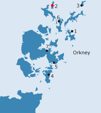
ORKNEY: O2. Papa Westray · Introduction
It is called Papy in meiri, or Greater Papay, only once in Orkneyinga Saga and then in connection with Earl Rognvald’s burial and to distinguish it from the smaller Papa Stronsay (Marwick 1925, 36). Otherwise it is referred to merely as Papa. In written descriptions and on the earlier maps the islands are usually distinguished; the exceptions are Blaeu (1654), Adair (1682), Wallace (1693), where one or both islands are just referred to as Papa (cf. Marwick 1925, 36). However, while there is clearly a difference in size, (it is said to measure 3-4 miles in length and 1 mile in breadth in OSA, 357, although in reality somewhat larger) the fact that Papa Westray is distinguished in this way may also reflect its status (see below). Even if Brand thought Papay was characterised by stony ground, ensuring that it was not as fertile as other islands (1701, 60), this was not the view of the author of the Old Statistical Account:
Papay is made up predominantly of fertile soils derived from drift deposits overlying the Old Red Sandstone and interspersed with shell sand (Lamb 1995, 16; Lowe 1998, 1; Rendall 2002, 33). These ensure, as Barry observed at the beginning of the nineteenth century, that the island has some of the distinctiveness of Sanday and North Ronaldsay in appearance and is more easily classified alongside them, rather than its close neighbour to the west, the far larger Westray (Barry 1805, 60; RCAHMS 1983, 7; Lowe 1998, 1). One of the reasons for this is the presence of farm mounds. These have only been recognised relatively recently, perhaps because, on Papay, currently occupied farms do not occupy these sites; the exceptions are the farms of Mayback and Via, the latter possibly a religious site (RCAHMS 1983, 7). However, Papay’s farm mounds are not as large as those on Sanday or North Ronaldsay; again the one exception is the probable site of an early chapel, Kirk of Howe (ibid.). In the earliest surviving rentals for Orkney – 1492, 1497-1503 and 1595 - Papay was earldom land, divided unequally ‘besouth the yaird’ and ‘benorth the yaird’ (Thomson, 1996, 62; Peterkin, I, 85-6; no. II, 74-5; RCAHMS 1983, 17). This division is shown on Mackenzie’s map of 1750 (Thomson, 1996, Map 8). Although three dykes are shown on Aberdeen’s map of 1769, it is the central one - the treb running into St. Tredwell’s Loch - which even though it is most probably of Bronze Age date, appears to have been re-used as the main division of the island (Marwick 1925, 33; RCAHMS 1983, 7, 17, no. 25; NMRS no. HY45SE36; SMR no. OR 780). The evidence from these early rentals implies that the island had originally been skatted as four urislands or seventy-two pennylands, again indicative of a fairly high degree of cultivation (Marwick 1925, 37; RCAHMS 1983, 17; Lowe 1998, 1).19 Sometime prior to 1595, the king’s land in Papay had been feued out to the deceased Gilbert Balfour of Westray (Marwick 1925, 44). In 1614, the leading families were Leasks and Howisons, but at a later date (from 1636), Papay had apparently belonged in its entirety to a gentleman called ‘Holland’ by Brand (1701, 60), a representative of the Traill family who lived at Holland (Marwick 1925, 37). The farm of Holland, which lies in a very prominent position, was of enough importance to be named on many of the earlier maps (Mackenzie 1750; Aberdeen 1769; Sawyer and Bennett 1781; Depot Generale de la Marine, Paris 1803a; Blachford 1846; cf. Marwick 1925, 44; Marwick 1952, 46; Burgher 1991, 98; Rendall 2002, 33; NMRS no. HY45SE27, 28, 38, 65 & 66, the house is at HY 4892 5152).20 In the twelfth century the ‘great lady’ and ‘wise woman’ called Ragna and her son, Thorstein, ‘a man of fine character’ had an estate in Papa Westray, although they seem to have lived in North Ronaldsay (Orkneyinga Saga, Taylor,218,246). This estate was probably to the south east of Holland, comprising the farms of Backaskaill and Breckaskaill which were believed by Clouston to make up the bu of Ragna and Thorstein,: - the two names perhaps indicating the splitting of an early udal property (probably called originally Skaill) between two heirs (Clouston 1927, 49; Marwick 1952, 45) Although there are now no surface indications, an old settlement site lying between the two extant farms is known to have existed (RCAHMS 1983, 14, no. 12; NMRS no. HY45SE41, OR 787, HY 4862 5085). Backaskail forms the main landing place on the west side of the island (Marwick 1925, 44; Marwick 1952, 45).
Papay’s status appears to derive from its ecclesiastical associations. Alongside a number of other, now more obscure, religious sites, there appear to have been two main ecclesiastical foci - St. Boniface’s and St. Tredwell’s - in Papay. The two principal sites have developed in very different ways, although each lies at the heart of a multi-period complex. Nonetheless, the fact that their dedications refer to two saints who were traditionally members of the Northumbrian mission to Pictland in the eighth century, an association first commented upon by Marwick (1925, 34-5), begins to hint at the context within which St. Boniface’s and St. Tredwell’s should be seen, one which is, at least partially, confirmed by the archaeological evidence (Rendall 2002, 33-5; see below). Although a cult around St. Tredwell (or Triduana) remained popular in the Norse period, St. Boniface drifted into obscurity; therefore, the juxtaposition of the two dedications would seem to be an indication of a firmly established pre-Norse church on Papay (Lowe 1998, 7). Boniface is usually assumed to be the Boniface who is associated with Nechtan’s mission to Pictland in the Aberdeen Breviary (see discussion in MacDonald, 1992, 14ff) although Rendall has recently proposed that it is Boniface of Crediton, who was martyred in the mid eighth century (2002, 37). In the majority of early sources, the dedication of the parish church is consistently given as St. Boniface.21 There have been suggestions that the sixteen unarmed men with shaven heads seen by Earl Rognvald Kali as he left church on Westray may have been monks from Papay, although this has been disputed by more recent commentators (RCAHMS 1946, 184, no. 526; Pálsson and Edwards 1978, 144; RCAHMS 1983, 18). Although evidence for a pre-Norse bishopric in Orkney is slight, resting primarily on later Norse sources and on the Life of St. Findan, the seat of the postulated bishopric has been tentatively associated with Papay (Thomson 1986; the evidence is discussed more fully by Lowe 1998, 8-9). Findan, having been captured by a Viking slave-raiding party who had stopped on a small, uninhabited island, escaped to a larger island close by, where he took refuge with a bishop; Thomson has suggested the two islands could be the Holm of Papay and Papay itself (Thomson 1986, 280-3; Lowe 1998, 8-9; Thomson 2001, 50). Lamb has also seen the island as the seat of a ninth- century bishop, who lay at the head of an ecclesiastical organisation, centred on the Peterkirks , which was already highly developed by the eighth century (Lamb 1993; Lamb 1995, 22-3; see discussion of these theories in Thomson, 2001,19-20). The choice of this small northern island could reflect the desire to expand the power of the early missionary church into Shetland. The sound between Papay and Westray, centred on Pierowall Bay, is the finest natural harbour in the North Isles; more importantly, it lies at the southern end of the most dependable sea route between the two island groups (Low 1778, 142; Gorrie 1869, 181-2; RCAHMS 1983, 8-9; Lamb 1995, 22; Rendall 2002, 35). As Lowe has indicated, the choice of Papay (and probably St. Boniface’s in particular) as the burial place of Earl Rognvald Brusison, following his murder on Papa Stronsay, almost certainly had political connotations (Lowe 1998, 4-5; see Site O1). The division of the earldom held by Rognvald’s father, Brusi, would have included the north isles, a connection maintained by Rognvald himself (Smith, 1988, 25). The decision on the part of Rognvald’s family and supporters to bury him on Papay may reflect the claim of St. Boniface’s to be treated as the pre-eminent church in the northern third of the divided earldom. This early medieval status did not survive the later establishment of Norse ecclesiastical organization, for Papa Westray was a pendicle of Lady Kirk of Westray at Pierowall from the late medieval period. Both churches were apparently united with the church of Holy Cross as one parochial cure before 1443 (REO, no. III, 81; FES, Vol. VII, 276; Tudor 1883, 356; Cowan 1967, 161). The parsonage revenues of Lady Kirk and Papa Westray formed part of the bishop's mensal revenues at the Reformation, and although the united vicarage appears to have remained independent, the actual cure was held by a vicar pensioner of Westray and Sanday (Cowan 1967, 161). The 1627 Report under the Commission for raising Teinds makes clear that, on the fall of the earldom, the patronage of the three churches had returned to the king (REO, no. III, 81). There were still three kirks in the parish of Westray at the beginning of the eighteenth century - two on Westray itself and one on Papay, presumably St. Boniface’s (Brand 1701, 59). Wallace’s map of 1693 names both St. Boniface’s and St. Tredwell’s, perhaps because the latter was an important place of pilgrimage until the early 1700s. As was the case in 1627, at the end of the eighteenth century, there appears to have been a single minister serving each of the churches in rotation - even if he only visited Papa Westray when the weather allowed (OSA, 359; Tudor 1883, 374). Although the manse was on Westray, part of the glebe lands lay on Papay and were identified as the only part of the island which was not in the possession of the Traill family by Armit (1841, 118).
St. Boniface’s church lies at the heart of a significant complex of archaeological sites; to the north and east is the extensive Iron Age settlement known as Munkerhoose, which has, at its north end, a farm mound of later date (Lamb 1983, 8; Lowe 1998, 1-3; Rendall 2002). The church itself has been largely rebuilt, although its plan - comprising nave and chancel - appears to preserve its twelfth-century form (Tudor 1883, 380; Marwick 1925, 33; RCAHMS 1946, 179; Lowe 1998, 4). It was extended westwards in the early eighteenth century - either by 8 feet in 1700 (RCAHMS 1946, 179) or by 28 feet in about 1720 (Marwick 1925, 33; Hay 1957, 267). It is probable that at the same time, the chancel was demolished and replaced by the Traill family burial vault (Tudor 1883, 380; Marwick 1925, 33; RCAHMS 1946, 179). The chancel arch is indicated today only in outline, as a void in the plaster on the building’s eastern exterior wall-face. However, its presence would seem to suggest that the east gable preserves medieval fabric (Lowe 1998, 4) - a blocked up window, with an arched head, visible on the inner side of the north wall, may also be an original feature (RCAHMS 1946, 179). Even though enlarged in the eighteenth century, the church was still tiny; the extension allowed room for a gallery, accessed by an external staircase at the west end (ibid.; Burgher 1991, 99). The church was in a poor state in 1841 (Armit 1841, 130) and, although repaired in 1843, it was again in need of further repairs at the beginning of the twentieth century (RCAHMS 1946, 179). St. Boniface’s went out of use in 1929 (Rendall 2002, 31), but has recently been restored. In the graveyard just to the east of the Traill burial vault is a hogback monument, one of a series of such house-shaped grave-covers which are found in north England and southern Scotland, mostly, and are thought to represent an idiosyncratic burial monument with Scandinavian colonial associations (Lang, 1974,1994 ; Ritchie, 2003; Crawford, 2005). There are a few in the Northern Isles, which are late in the series and probably all twelfth century. It lies on an east-west axis, the broader end to the west, and has a plain upright slab at its west end (Kirkness 1921, 132; Marwick 1925, 33; RCAHMS 1946, 179; Lang 1975, 220-1, 230; Lowe 1998, 4). Although much weathered, the stone has a deep ridge along its spine, three rows of rectangular tegulae on either side and is made of red sandstone (RCAHMS 1946, 179; Lang 1975, 220-1, 230; Lowe 1998, 4). Its form suggests that it, like the church, is of twelfth-century date (Lang 1975, 220, 230). Locally, the stone was believed to have been brought in the early 1800’s from Herti or Heartie Geo, a rocky inlet 400m north of the church, although little credence has generally been given to this story:
Within and around the churchyard at St. Boniface’s there have been a number of finds of early medieval date. In 1920, when burials took place on the north side of the church for the first time within living memory, a cross slab - of unusual type and probably not much later than about AD 700 in date - was found in a grave at a depth of about 0.9m (Kirkness 1921, 134; Marwick 1925, 33-4; RCAHMS 1946, 180, no. 520; Radford 1962, 169; Lowe 1987, ii, 122-6; Lowe 1998, 6; Fisher 2002, 49; NMRS no. HY45SE17.1, HY 4882 5270). The incised, compass-drawn cross, formed from interlacing segments of circles, set within a circle, recalls the St. Peter stone at Whithorn, as well as examples from the Inner Hebrides and Argyll (Kirkness 1921, 134; RCAHMS 1946, 180; Radford 1962, 173; Fisher 2002, 49; Rendall, 2002, fig. 2.2). The main cross is surmounted by an equal-armed crosslet, also incised; this has crescentic terminals and is set into a pedestal base (RCAHMS 1946, 180; Fisher 2002, 49; Rendall, 2002, fig.2.3). This slab is made from a smooth piece of flagstone, broken at the time of discovery.- (Fig. 02.4). It contrasts markedly with a second carved stone - a tapering, worn boulder, probably from the shore - found at a depth of 0.3m in 1966 or 1967, during grave-digging at the north-east corner of the medieval nave (Lowe 1998, 7; Fisher 2002, 49). Although its surface has been damaged, what appears to be the main face displays a cross of arcs carved in relief, again suggesting influence from the western seaboard of Scotland, below a plain Latin cross. The circular armpits of the upper cross would seem to be indicative of a ninth century or later date, while to the left of it faintly incised designs or figures are visible (Fig.02.5). There are also traces of a rectilinear pattern on the back of the stone (RCAHMS 1983, 18; Lowe 1998, 7; Fisher 2002, 49 . From below the excavated cliff section, part of the adjacent Munkerhoose, a fragment of a possible shrine panel was identified in 1992 (NMRS no. HY45SE68, HY c. 48 52). The surface of the panel appears to have been divided into four fields by a number of pecked and smoothed grooves forming a cross, while the only remaining edge of the slab is rebated as if it had been inserted into the mortice of a corner-post (Lowe 1998, 7; Rendall, 2002, fig.2.4). In the upper right hand field is what seems to be a Pictish ‘rectangle’ or ‘comb-case’ design (ibid.). If this identification is correct, then this fragment would seem to be of eighth century date and to be a reflection of Northumbrian influence (ibid.). Although not specifically ecclesiastical, the bone comb fragments recovered from an exposed midden section in 1975 are also probably of eighth-century date (Lamb 1995, 19; Lowe 1998, 6). Between the churchyard and the cliff edge are the extensive and very visible remains of earlier settlement (NB, Orkney, Book 26, 11; RCAHMS 1946, 184, no. 526; RCAHMS 1983, 18-9, no. 29; Lowe 1990, 45-7; Lowe 1998; Rendall 2002; NMRS no. HY45SE26, HY 487 527). The name ‘Munkerhoose’ was given locally to this area from at least the late nineteenth century (RCAHMS 1946, 184). Mungerhouse is applied to a sub-oval enclosure below the top of the cliff edge on the First edition map, with Kirk Geo immediately to the east of the chapel. Marwick believed that the adjacent name, Clyar, which he derives from the Gaelic word cliar, clergy, might have arisen from the superstitious belief that the black rocky pinnacles, which dominate the rocky beach to the east of Munkerhoose, were petrified monks (ibid.). The site has attracted much attention since that period:
Marwick also recorded antiquarian excavations, perhaps by Captain Thomas, about which stories are still current on the island (J. Rendall, pers. comm., quoted in Lowe 1998, 10). Locally, the site was believed to have extended under the church (RCAHMS 1946, 184) and, over the years, a number of structures have been identified during gravedigging. It was reported to Lowe that several ‘cart-loads’ of stone had been removed from the graveyard, while stretches of drystone walling have been recorded at a depth of 1.5m along the southern boundary wall of the graveyard; another possible passage was encountered in 1982 on the west side of the extension to the burial ground (1998, 11). The degree of erosion which had taken place by the end of the twentieth century necessitated modern recording and evaluation of the exposed cliff section, approximately 125m long and up to 4m deep in places, in 1998 (Lowe 1998, 2 and passim, illus. 2). This evaluation was combined with a contour and auger survey of the area between the cliff edge and the graveyard (Lowe 1990; 1998). Although Radford suggested that Munkerhoose represented a doubtful example of a smaller Celtic monastery (Radford 1962, 169), the remains themselves suggest that occupation began in the early third millennium B.C. (Lowe 1998, 199). At the lowest level, cattle bone, presumably associated with Neolithic occupation of the site, was found mixed in with the blown sand deposits covering the natural till (ibid. and passim). Stratigraphically later was a grave, aligned roughly NE-SW and probably containing the bones of a child, along with a pit, cairn and structural remains, all dug into or resting on the primary surface. In the later Bronze Age, the emphasis of the site seems to have shifted from funerary to domestic, a feature of other similar sites in the Northern and Western Isles (ibid., 199-200). The remains from this level are fragmentary, but consist of the footings of a free-standing cellular building, similar to those found at Jarlshof, along with a number of other possible structures (ibid., 200). Although there is no evidence that this phase of settlement was enclosed, it does not extend beyond the limits of the later settlement, which - by this date - was focused on a substantial roundhouse or broch. While some of the buildings of the earlier phase were levelled, others appear to have remained in use alongside the roundhouse; even more significantly, the earlier funerary deposits appear to have been incorporated into the fabric of the roundhouse (ibid., 200, 202). The roundhouse or broch, which is most likely to have been constructed in the second quarter of the first millennium B.C., appears to have been solid based, but has a number of other traits usually associated with brochs: checked entrance, bar-hole, guard cell and external settlement, which - at least in its later phases - respected the form of the main structure (ibid., 201-2). No evidence for intra-mural passages or a scarcement ledge was visible, probably largely because of erosion or later collapse (ibid., 201). Structures outside the roundhouse fell into a number of main building phases, each of which were superimposed on top of each other. Again no evidence of enclosure was found during the primary roundhouse phase, while the associated buildings were surrounded by large shell middens (ibid., 202). In the succeeding period, the settlement was enclosed by a stone-revetted ditch and wall, although the reasons for this are not apparent from the archaeological record. In this phase, dating to the end of the first millennium B.C., the buildings within the enclosure were laid out radially around the principal structure. In the early first millennium A.D, the ditch was recut and the buildings around the entrance to the enclosure were refurbished (ibid., 202-3). Later again, the formal pattern of settlement around the roundhouse seems to have broken down, even though - in spite of stone robbing - it continued to form its focus. Ritual deposits, including human and animal remains, were associated with this phase of occupation, again paralleling the evidence from other contemporary sites (ibid., 203). The early medieval finds from within the present bounds of the churchyard suggest that the ecclesiastical focus in this period was under or close to the present church. However, it is possible that it lay to the north, where significant amounts of stone, close to the surface of the ‘farm mound’ and immediately outside the churchyard wall, were encountered during the auger survey (ibid.; Carter 1998, 191). The mound to the north of the church has been identified as the Binnas Kirk, from the ON boen-hus, meaning prayer house or chapel:
These stories about Binnas Kirk are still faintly remembered in local tradition, but are not precise enough to enable an accurate assessment of their meaning; the name Binnas seems to have been confused with Boniface in local etymology (RCAHMS 1983, 8, 18; Lowe 1998, 1-2, 203-4). If ecclesiastical activity was focused on areas adjacent to the earlier Iron Age site, St. Boniface’s would contrast markedly with many similar sites in the Northern Isles - such as St. Tredwell’s (see below) - where the two phases of occupation are directly superimposed on each other (Lowe 1998, 204). The reasons for this displacement may be as much practical as symbolic and it is not clear that this shift in location, if real, necessarily represents continuity of occupation; although the cliff section implies that the core of the settlement had been long abandoned, the roundhouse may have been still standing at this date. Several fragmentary structures and a large sub-rectangular building to the east of the roundhouse and connected to it by a flagged passageway, are stratigraphically later than the buildings associated with the roundhouse. However, the precise chronology is far less clear and it is possible that the structures are medieval in date. Within the cliff section a deep soil, extending to the north of the enclosed Iron Age settlement, has been radiocarbon dated to the period AD 500-700 (ibid., 205). On analogy with Iona, this has been suggested to represent part of the ‘economic package’ of the early Church, even if the dates from St. Boniface’s are rather early to fit in with the accepted chronology of the church in Orkney (ibid.; Simpson 2002, 65-6). Therefore, this soil should perhaps be seen as an indigenous development, potentially only linked to ecclesiastical activity on the site during the final phases of its slow and intermittent deposition; if this is the case, then it does imply some continuity between the Late Iron Age and the early ecclesiastical site (Lowe 1998, 205-6; Simpson 2002, 66). The development of this soil was followed by conditions which allowed heather-rich moorland to form (Lowe 1998, 206). This suggests a period of long term stability and a lack of human disturbance, which is not readily explicable, given the nature of the ecclesiastical finds from the churchyard and the postulated history of the site. Around 1100, the old land surface was buried by the extensive ash deposits forming the upper part of the ‘farm mound’. At the base of these deposits were several lumps of impressed mortar, suggesting the demolition of a high status building - presumably ecclesiastical - prior to this date. The mortar suggests that this event could have taken place no earlier than the beginning of the twelfth century; its presence may be indicative of the refurbishment of an earlier building or perhaps the erection of the present church (ibid., 9-10, 206-8). There is nothing stylistically Norse amongst the few finds from the ash mound, but it is presumed that it does represent fish processing on a commercial scale associated with an, as yet unidentified, secular settlement of similarly high status nearby (ibid., 207-8). This phase appears to be of relatively short duration, being abruptly abandoned (ibid., 209). The two smaller mounds, identified during the contour survey, to the north and south of the main ‘farm mound’ have been presumed to be later in date; that to the west of the church incorporates an east-west aligned rectangular stone building, while the northern mound forms a roughly square platform, although no structural features are apparent (Carter 1998, 190-1). Other structures, including a boat ‘naust’ (shelter) and a number of possible kelp kilns, are visible in the southern part of the complex. The obscurity of the later history of St. Boniface’s, as of Papay as a whole, may well reflect the increasing marginalisation of the north isles, as first Birsay and then Kirkwall rose to prominence. In the late medieval period, however, St. Tredwell’s chapel on Papay was renowned in Orkney and beyond (Wallace 1693, 13, 24; Brand 1701, 60) A ‘small chapel’ on an island in St. Tredwell’s Loch is first mentioned by Jo. Ben in 1529 (Ben 1529, 316) and, while no longer an island at the end of the seventeenth century, recent geophysical survey has confirmed that this was indeed once the case (Bowman 1992, 82). Although both Wallace and Brand give contemporary - and very similar -descriptions of the chapel, Brand’s is far more detailed:
That the importance of St. Tredwell’s had begun to decline by the end of the eighteenth century is indicated both by Low (1778, 150) and by Barry (see above), as well as by the author of the second Statistical Account:
By the end of the nineteenth century, Gorrie could refer to it as a ‘fairy-isle’ (1869, 190).
However, little of this architectural elaboration was visible to Dryden during his survey in 1870, when he described the chapel as:
A few years after Dryden’s survey, Traill adds the information that the chapel had been lime mortared and that a window was located opposite the door (PSAS 1883, 137). Traill cleared away ‘the stone and rubbish’ from inside the chapel, finding ancient coins at floor level, as well as human remains (ibid.; Marwick 1925, 34; RCAHMS 1946, 180; RCAHMS 1983, 19). The coins were all of copper and, along with two French and Dutch coins, dated to the reigns of Charles II, George II and George III (PSAS 1883, 137). The ‘human remains’ were those of woman found in a cist about 7’ 6’’ beyond the east face of the chapel. The chapel described by Dryden and Traill is the larger of the two buildings shown on the First edition OS map; the smaller building on top of the mound may be an earlier chapel (Radford 1962, 171-2). A more modern enclosure is also shown on the map to the south east of the chapel. The battered wall, which surrounds the base of the mound and is most clearly exposed on its south west side, would seem to be associated with the putative broch contained within the mound itself (RCAHMS 1946, 181; RCAHMS 1983, 19). During his excavations, Traill noted the presence of a circular building, 15 feet in diameter and with a door in the southern arc, immediately to the north of the chapel, while he encountered another structure, full of earth, below the floor of the chapel (PSAS 1883, 137). Looking for the latter building outside the chapel, Traill discovered a passage ‘clear enough for a person to enter when first found’ about a foot below the surface; the passage was only 18’’ wide and ran in a northerly direction for about 10 feet, before turning slightly to the west and continuing for another 23 feet to terminate at what appeared to be a circular structure (ibid.). The entrance to this building was guarded by a corbelled cell on the north side and the passage was checked for a door on at least two occasions along its length (ibid.). An iron spearhead, a stone ball made of serpentine, a number of bone artefacts (playing-disc, ring and dice), charred grain, along with a large amount of red and brown pottery sherds, some of which were glazed and ornamented with impressed decoration, have all been found on the site (information contained in NMRS record). On the south east side of the mound was a midden, full of shells and broken pottery, and possibly associated with a building (PSAS 1883, 138) and further midden deposits have been identified through geophysics (Bowman 1992, 82). The diameter (35m) and height (4.5m) of the mound do imply that it contains a broch (RCAHMS 1983, 19) and, although interpreted by Radford as a souterrain (1962, 171-2), it is possible that Traill’s passage gave access to structures which once surrounded it. Whether or not these features are contemporary or of later date is less obvious. Although the walls of the chapel still stood to the height noted by Dryden in 1930, much of the mound is now overgrown, while the chapel and passage are choked with tumble; the two squarish piles of stone against its south wall are Traill’s spoil heaps (RCAHMS 1983, 19). However, recent contour survey has identified a buried causeway, a probable landing area for boats and confirmed that the site did not extend beyond the low enclosure wall (Bowman 1982, 82). Local informants told the OS surveyors in 1973 that a large stone cross had been found in four feet of water just off the south west side of the promontory (at HY 4964 5088), but that it had not proved possible to raise it (information contained in NMRS record). No trace of the standing stones mentioned by Brand as existing near to St. Tredwell’s remained in the nineteenth century (RCAHMS 1946, 186, no. 543; RCAHMS 1983, 13, no. 4; NMRS no. HY45SE24, HY 496 508). There is also no trace of the Messigate, the ‘mass road’ which is meant to have run from the Knowe of Burland, a settlement mound lying to the east of the loch (RCAHMS 1946, 185, no. 536; RCAHMS 1983, 16, no. 19; NMRS no. HY45SE11, SMR no. OR 785, HY 4987 5076), westwards towards St. Tredwell’s Chapel (Marwick 1925, 35; RCAHMS 1983, 22, no. 51; NMRS no. HY45SE 58, SMR no. OR 794, HY 4987 5076 to 4964 5088). According to Tudor, St. Triduana ‘had almost as many aliases as a London pickpocket’ (1883, 379), Marwick was puzzled specifically by the occurrence of the Scottish form, Tredwell, of the saint’s name in Papay.22 He believed that it could have been Scotticised during the medieval period, but that an earlier Norse version of the name had been preserved as Trallyo, a fishing ground to the north-east of Papay, which is located by lining up a point on the east side of the island (Niel’s Hellie) with St. Tredwell’s chapel (1925, 34-5). It is possible that, given the nature of the traditions surrounding the loch and the chapel, that it should be seen as a pagan religious site, appropriated by the church in the first millennium A.D. - Tredwell may herself have been a pagan goddess who was reinvented in saintly guise (Rendall 2002, 35-6). The way in which the early medieval religious site functioned is rather more obscure; Rendall has proposed that the relatively isolated and damp location of St. Tredwell’s indicates that it was a place of retreat (ibid., 35). However, it is perhaps also significant that the two principal ecclesiastical sites on Papay lie just to the north or south of the main division of the island ‘benorth’ or ‘besouth’ the yard (Clouston 1918, 238).
Including St. Tredwell’s, the number of chapel sites on Papay is usually given as two, although both Tudor and Clouston allow that there may have been more (FES, Vol. VII, 276; Tudor 1883, 374; Clouston 1918, 238). However, Anderson’s reference to the second chapel on Papay being dedicated to St. Nicholas has been suggested by Marwick to be simply a mistake (PSAS, 11, 369; FES, Vol. VII, 276; Marwick 1925, 34). Given the prominence of both St. Boniface’s and St. Tredwell’s, it is striking that traditionally there were two further church sites within the central part of Papay. The Kirk of Howe, which Scott mistakenly believed to be the parish church, was described in 1841:
The site of the chapel is shown on the OS First edition map, in an area of rough ground, immediately south east of the farm of Quoys, formerly Howe. The next farm south is Kimbland, formerly Quoys. Marwick noted that the church was still well-known at the beginning of the twentieth century and that it appeared to have been constructed on top of a broch mound, although no traces of the church were recognisable at the time of his visit (1925, 33, 35). He was informed locally that the church had had three doors, one in the north and south walls and one at the west end; these doors had a specific purpose, as ‘there were many divorces in those days, and the divorced man had to go out of one door on one side of the church, and the divorced woman on the other’ (ibid., 33). The name, kirk of Marro or (less commonly) Mallo, is applied to a channel used by boats going out to sea, which lies to the north of the Holm of Papay and is located by aligning what must be the mound on which the Kirk of How is situated with the “Grip (small ditch) o’Cott” (ibid., 33, 35). Marwick has suggested this form of the name may represent the Celtic founder of the chapel, proposing that Marro or Mallo is a corruption of Moluog, a saint who was closely associated with Rosemarkie, prior to St. Boniface’s arrival there (ibid., 35-6). Petrie noted a standing stone with a hole through it standing near ‘to the ruins of the Kirk of “Hoo”, which are evidently those of a Popish chapel and appear to have under them the ruins of a Pictish house’ (Petrie 1927, 28; this may simply be confusion with the stones seen near St. Tredwell’s (RCAHMS 1983, 13, no. 6; NMRS no. HY45SE15, SMR no. OR 818, HY 4933 5306; see above). At around the same time, the underlying mound was described by the RCAHMS as of great extent, but of very irregular outline (RCAHMS 1946, 185-6). The mound had been partly cut away by the public road and, perhaps as a consequence of this proximity, has been extensively quarried into, revealing a make up of black earth, sand and limpet shells (ibid., 185; RCAHMS 1983, 15). The mound crowns rising ground, so its precise limits cannot be defined, but its diameter must be at least 90m (RCAHMS 1983, 15). Although it is centred at HY 4932 5309, there is now no trace of the chapel which the Ordnance Survey originally located on its southern slope, at HY 4933 5306 (ibid.). A destroyed burnt mound noted near Kirk of Howe in the first RCAHMS report may simply represent confusion with the principal mound (RCAHMS 1946, 185, no. 553; RCAHMS 1983, 13, no. 6; OR 813). According to local tradition, another chapel lay at Via, a name thought by Marwick to derive from the ON ve, ‘sacred place’; since Via is more commonly applied to a place of pagan worship, he believed it to represent the Christian appropriation of an earlier site (Marwick 1925, 33; RCAHMS 1946, 186). The two settlements of North and South Via occupy an elongated farm mound running parallel to the shore, but - probably because of these later developments - there is no trace of any chapel (RCAHMS 1983, 16, no. 22; NMRS no. HY45SE46, SMR no. OR 815, HY 4980 5324). The mound, itself, may also account for the final -o, reflected in the local pronunciation of the name as Veeo, which suggests that the original suffix was ON haug(r), holy mound (Marwick 1952, 47).23 Finally Brand implies the presence of yet another chapel, seemingly associated with a nunnery:
Brand’s description must apply to the Holm of Aikerness, which lies between Westray and Papay, immediately to the south west of St. Boniface’s church. Only the central part of the Holm, amounting to about half an acre, is never submerged by the tide; however, the foundations of a small chapel, adapted as a shed for sheltering sheep, but apparently consisting of nave and chancel, was reported to the RCAHMS in 1928 by W. Traill, Holland (1946, 360, no. 1067: RCAHMS 1983, 41, no. 177). Nothing now appears to be visible and no local knowledge of the site survives (RCAHMS 1983, 41; Lowe 1987, ii, 155-8; Lowe 1998, 7; NMRS no. HY45SE20, SMR no. OR 760, HY 4697 5250).
These small low-lying fertile islands in a ‘retired situation’ exemplify the ‘well-endowed’ model of off-shore island communities of ‘papar’. Assuming that the communities possessed these whole islands in their entirety there is likely to have been one communal place of residence with its own place of worship. In Papa Stronsay these have been located around St. Nicholas’ Church, underneath which a cellular building of Iron-Age date was discovered, and in the vicinity of which the early Christian inscribed stone was found. In Papa Westray the extensive Iron-Age settlement at Munkerhoose is close by St. Boniface’s, and the early Christian stones found there are undeniable evidence of an early Christian community in this vicinity-either secular or ecclesiastical. The chapels, St. Bride’s in Papa Stronsay and St. Tredwell’s in Papa Westray are perhaps different. The chapel of St. Bride is more likely to have been a Norse-period foundation close by the main medieval farm on Papa Stronsay, while St. Tredwell’s could also be a Norse family chapel, but the dedication has been taken to indicate a continuity of Christian worship at this site from the Celtic period. However we should note that there is good evidence from the Orkneyinga Saga that Tredwell was revered in Caithness in the Norse period, for Bishop John of Caithness had his sight restored by praying to her after his blinding in 1201 (OS, Palsson and Edwards, chap.111). Her cult might have been introduced into Orkney at this time.
· Soil Survey of Scotland Class 42
OS maps:
|
||||||||||||||||||||||||||||||||||||||||||||||||||||
21it is only Scott who names the dedicatory saint as St. Curadan - or Curitan - of Rosemarkie, the Celtic name for the St. Boniface of the Aberdeen Breviary (FES, Vol. VII, 276; Marwick 1925, 34). While Scott does not appear to have been that familiar with the Orkney situation - he conflates St. Boniface’s with the Kirk of How - Marwick recorded another placename, Curran’s Towmal, which seemed to him to contain Curitan’s name, although this is unlikely (Marwick 1925, 34). |
||||||||||||||||||||||||||||||||||||||||||||||||||||
)
)
)
)
)
)